In November, BC Behavioural Insights Group (BC BIG) released The First Four Years, a report of the first years of our work. We included case studies of some of the projects we’ve done around the province, including designing better maps to protect mountain caribou, helping British Columbians unemployed due to the pandemic return to work, and improving the management of groundwater in the province.
Over a series of blog posts, we will shine a spotlight on individual projects and invite your questions.
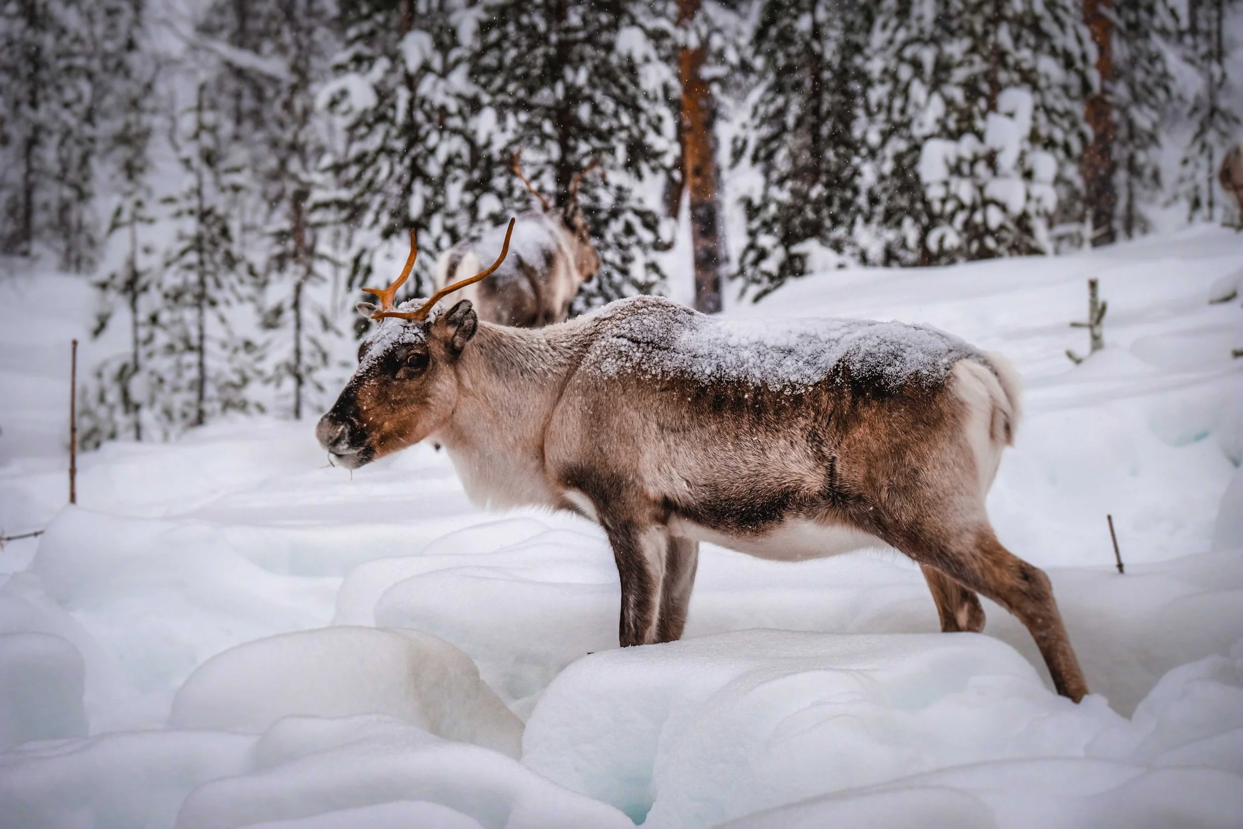
Photo by Francesco Ungaro from Pexels
CASE STUDY SUMMARY
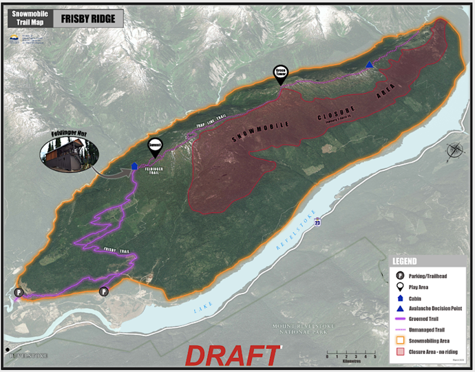
We surveyed 450 snowmobilers including members of five snowmobile clubs and learned they found it hard to know when they were in restricted areas. So we worked with partners to create simpler tools including new trailheads maps and a mobile app.
The Challenge
The British Columbia Ministry of Forests, Lands, Natural Resource Operations, and Rural Development is responsible for protecting Southern Mountain Caribou by reducing disturbance in their habitat. The Ministry monitors over one million hectares of caribou habitat. While most snowmobile riders avoid closure areas, even a minor disturbance can force caribou into areas with increased risks, such as exposure to predators, avalanches, and reduced access to food. Encouraging riders to stay out of closed areas will help protect caribou.
The Approach
BC BIG conducted research with the snowmobiling community in British Columbia to learn more about their experience with closure areas. This research included interviews, site visits, and an online survey with over 450 snowmobilers. From this research we learned that most snowmobilers want to follow the rules, but they either do not know what the rules are or where the boundaries are for riding. To address this, we worked with GeoBC, a government unit that manages mapping information, to develop prototypes of two mapping products: 1) a digital planning and riding app, and 2) simple, user-friendly maps posted in riding areas. Through feedback sessions with snowmobiling clubs and a second online survey with riders, we learned what riders liked and disliked about the prototype solutions, helping us further improve the app and maps.
The Product
The posted maps present closure information in a 3D format that helps riders orient themselves to the location of closures, while drawing attention to relevant terrain details. Through geolocation, the riding app allows riders to determine where they are in relation to closures and other points of interest. Due to logistical challenges, it is not possible to run a rigorous evaluation. As such, data on the effectiveness of the tools will be gathered through qualitative feedback with the snowmobiling community. This feedback will be used to further improve the final products and inform future initiatives. Our behaviourally informed prototypes give snowmobilers the information they need when they need it.
Behavioural Insights Used
Timing
We created the app and maps to enable snowmobilers to access the necessary information when they need it.
Simplification
We simplified the posted maps to contain only key information. We designed the app to show only the details needed by the riders by default. We used consistent icons between the app and the map.
Framing
Previous maps displayed a large area, which focused attention on surrounding closures (where to avoid). Our revised maps zoom in to focus attention on open areas (where to go).
Salience
We used 3D satellite images so riders can recognize landmarks and reference where they are relative to closure boundaries.
Behaviourally informed signs and app that simplified necessary information for snowmobilers could have far reaching positive effects for caribou in these regions. How have you used simplification? Let us know in the comments.